“When are we going to use this in the real world?” This is the question that most people ask themselves when learning something new in the academic world. Every once in a while, new tools are created, many of them to merge “technology” and “literature”. In our case, Google My Maps is a way to keep track of relevant places by allowing users to customize maps with their own markers, routes and shapes.
Our first experience with Google My Maps came recently when our digital humanities class required us to map literary texts to test whether Geographic Information Systems (GIS) technology can be used to further the understanding of the literature of place and space. While reading about settings we don’t often consider the distances between areas. However, the classics do not always offer helpful visuals: sometimes understanding the distance and difference between different places can affect the plot or meaning of the work; and in that case a map would truly help us connect with the material we are reading. Maps often help visualize the setting in novels, as well as social relationships between different characters. We could create maps of the places mentioned in novels and compare the settings and the true descriptions of the places to what’s written in the story. These visual aids would help bring the text alive and connect the stories to the authors themselves.
A map says to you: Read me carefully, follow me closely, doubt me not… I am the earth in the palm of your hand.
Beryl Markham
Our project revolves around the works of Robert Louis Stevenson, so we decided to create four different maps. The first was a map marking his life achievements. However, the three others were setting maps of The Strange Case of Dr Jekyll and Mr Hyde, Treasure Island and Kidnapped.
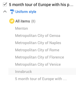
Robert Louis Stevenson’s life achievements


By mapping Robert Louis Stevenson’s life achievements, we got a deeper insight of what made him who he is:
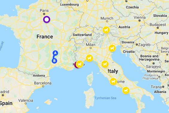
- The author is very well travelled. As the map shows us, he has visited pretty much all of Europe as well as the United States and many islands on the Pacific Ocean.
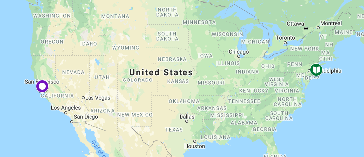
- The author was always on the move. As the map shows us, he never settled in a specific place. Moving from Edinburgh, to the United States, to France… and finally spending his final days in the Samoa Islands where he was buried.
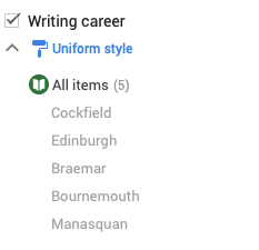
- The author’s travels led him to meet a lot of influential people who helped him in his writing career. For instance, he met Sidney Colvin in England who eventually became his literary adviser and was the first editor of his letters after his death. Colvin also placed Stevenson’s first paid contribution in The Portfolio, an essay entitled Roads. Another person he met along his travels was Will Lowe in Manasquan, New Jersey who later translated Treasure Island into the official French version in 1890.
- One of the author’s trips led him to find his big love. The canoe voyage Robert Louis Stevenson conducted with Simpson in 1876 brought him to Grez in September 1876 where he met Fanny Osbourne who he later married in 1880 and spent the rest of his life by her side.
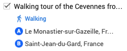
- Being the adventurous writer that he is, we found out that his exploring tours inspired his writings a lot. Stevenson often played a primary role in his tales of travel, and he was very willing to poke fun at his own discomfort and awkwardness in strange situations. A classic example was the book he wrote after his walking tour of the Cevennes in 1878. Travels with a Donkey in the Cevennes colourfully recounts the author’s inability to get his donkey, Modestine, to move.
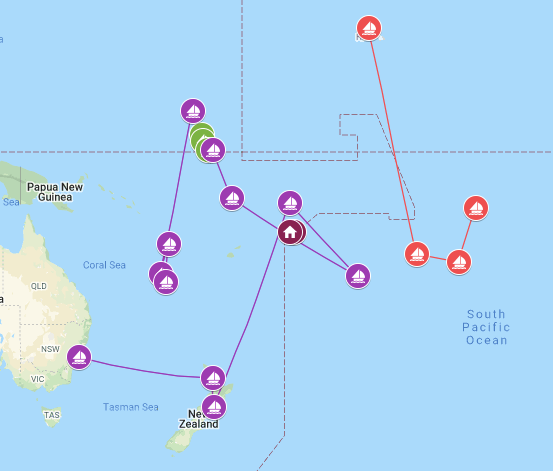
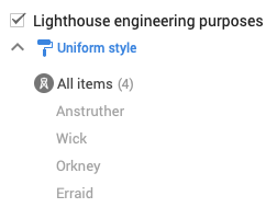
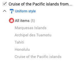
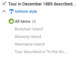
- The places he visited and the people he met inspired the settings and the characters of his novels. It was during his time in Bournemouth that he wrote his famous story The Strange Case of Dr. Jekyll and Mr. Hyde, naming the character Mr. Poole after the town of Poole which is situated next to Bournemouth. In Westbourne, he named his house Skerryvore after the tallest lighthouse in Scotland, which his uncle Alan had built. On the other hand, he took part in a cruise visiting the South Pacific Ocean islands in 1889 which he described in In the South Seas.
- The author chose Samoa to spend his last days in. Samoa was his go-to place because Stevenson liked the people, it was not too “civilized” and had a regular mail service which was essential for his connections with agents, editors and publishers. He died there of a cerebral hemorrhage and was buried on the summit of Mount Vaea on Upolu. The Samoans cleared a path to the top of the mountain overnight in order to be able to bury him there.
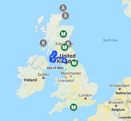
Contrast between close reading The Strange Case of Dr. Jekyll and Mr. Hyde and mapping the locations of the story
Having read The Strange Case of Dr. Jekyll and Mr. Hyde, the story grabbed our attention since it was very intriguing and mysterious. Every major event occurring kept us on the edge of our seat; but we didn’t pay much attention to the timing and location of the events as much as we did to the events themselves.
Now, having mapped the novel on Google My Maps, we can clearly see how Robert Louis Stevenson calculated the timings and locations of major events occurring in his book. The story made much more sense, and as readers, we could feel that it was more interesting knowing and to visualize where did these things happen exactly, whether it be for the character swap between Dr. Jekyll and Mr. Hyde’s split personality, or having an insight on where brutal killings took place.
The Strange Case of Dr. Jekyll and Mr. Hyde


Servants, discrepancy between rich and poor, the repression? That’s all 100% Victorian England. This setting allows Dr. Jekyll to become a more sympathetic character. It also explains why he needed to unleash his inner Hyde. In fact, you could go so far as to say that this book, because of its setting, provides social commentary on the place and time.
The Victorian London setting is important because it is what pushes Jekyll into making Hyde. Stevenson had apparently considered setting his tale in Edinburgh, with its poverty-stricken old town and illustrious new town making clear allusions to Jekyll and Hyde’s personalities again. However, in high London society, a man’s reputation was everything, he couldn’t do whatever or whenever he pleases. Jekyll is repressed by his lifestyle as a rich doctor, it is only as Hyde that he can do what he actually wants and so he creates Hyde. The setting is important here because it is what forces Jekyll’s hand into making an alternative person for himself.
Moreover, we realized that Jekyll’s house is really close to Hyde’s place which could be understandable since they are the same person. Hyde terrorises the occupants of London as he will trample and destroy anyone who gets in his way – the little girl and Sir Carew (as they are plugged in the map). London’s twisting medieval streets and fogged new streets become the maze in which the minotaur was kept. You never know when the minotaur or Hyde might appear to hurt you. Setting then becomes a metaphor for evil.
Kidnapped

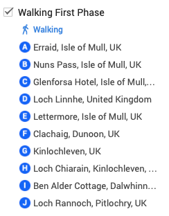

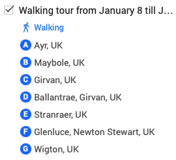
Kidnapped takes place in 1751 in Scotland, which is Robert Louis Stevenson’s home country. After researching Scotland’s history at the time, we found out that it was subdued by the English military. To clamp down on clans wanting independence, the English have started imposing laws on Scottish people to prevent them from carrying or owning weapons and wearing traditional Highland dress since their clothes can be related to an affiliation to a clan.
Davie, the protagonist, is a Lowlander and loyal to the English throne. So while there’s a fair amount of admiration for the Highland rebels, ultimately, Davie does return to the Lowlands with Alan in tow. Davie is a stranger to the Highlands, and his introduction to this unfamiliar country is as intriguing to him as it is to the reader.
We advise readers of this novel to keep a map of Scotland around them while reading, or in our case, to constantly check the locations and its corresponding legend that we mapped on Google My Maps since this will make the story a lot more interesting and easier to follow. Stevenson is very committed to get both his geographical and historical facts straight, so it’s possible to trace the route that Davie and Alan are supposed to have traveled around the northwest of Scotland, shown by the different blue points on the map. By including so much detail in a fictional adventure story, Stevenson increases the plausibility of what might otherwise seem like a pretty far-fetched story of shipwreck, conspiracy, and murder.
Problems we encountered while mapping
We can definitely say that mapping Stevenson’s life achievements and literary works helped us with our analysis in order to understand more the duality of evil and good, especially in The Strange Case of Dr Jekyll and Mr Hyde. Let us not forget how much the colored icons and lines in the maps are aesthetically pleasing to the eye.
However, while working on Google My Maps, we encountered some issues. At first, it was a bit of a challenge not knowing how to get all locations of Stevenson’s books since we were not that familiar with Topotext. Later on, while mapping the author’s life we faced numerous problems. On one hand, there were some unfound locations, probably due to the present absence of some monuments or the change in their names. On the other hand, the limited number of layers was also an issue for us since Robert Louis Stevenson visited a lot of countries for different reasons. So, we were limited to 10 layers which made us filter and include only the important parts of Stevenson’s life.
But regardless of these issues, mapping Stevenson’s literary works and his life achievements was a great experience!
Hope you enjoyed our blog about mapping!
Anna, Marc & Tara
